"Few places in this world are more dangerous than home. Fear not, therefore, to try the mountain passes. They will kill care, save you from deadly apathy, set you free, and call forth every faculty into vigorous, enthusiastic action." John Muir
"I highly doubt you're going to make it." The ranger looked at me with skepticism on his face. He had asked my plans, and I had asked about river levels. My plan was to hike in over Piute Pass to the JMT then south on the JMT and out over Bishop Pass. The two trailheads are located fairly close together and it would be relatively easy to hitch or just hike between the two. I was worried a bit about river crossings and was looking for any info I could find on the section. I checked out photos from the JMT and Sierra Nevada Current Conditions pages on Facebook. PCT through hikers were making it north, but I wasn't so sure about the Bishop or Piute trails. My plan was to be safe, cross high creeks with other hikers, and turn around if it just got to be too much. I was hoping the ranger would have helpful information, but insteady I left the office, permit in hand, feeling defeated.
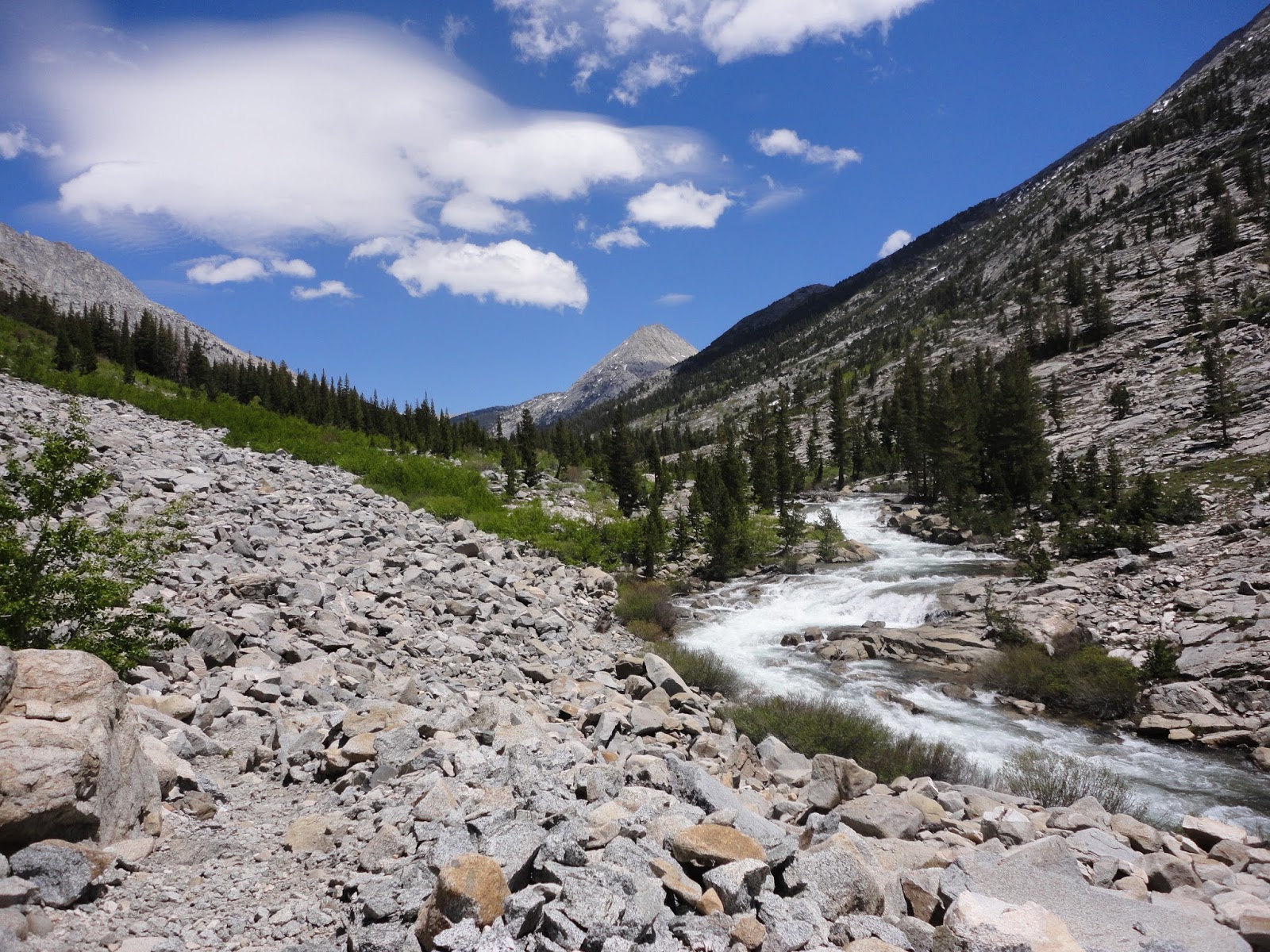
Day 1 I got a late start as I was waiting for my microspikes to be delivered. I had ordered them weeks before, but they had forgot to ship them and then ended up overnighting them to Tahoe. I ended up leaving Tahoe around 1030am and went straight to the ranger station to pick up my permit. After being told that creek crossings were too high and the snow too deep I started out in pretty low spirits. This quickly turned around as I started up the trail and became enchanted by the beauty of the snow and granite. I made it past Loch Leven and Piute Lakes as the sun started to set. I quickly set up camp and called it a night.

Just before Loch Leven Lake

Loch Leven Lake? or Piute Lake?
Day 2 I got an early start wanting to walk on firmer snow. The climb up Piute was amazing and I had no trouble with navigating over the snowy trail. I brought maps, compass, and I had downloaded the maps on the gaia app.

Looking back over Piute Lake from the climb.
The view from the top of Piute looking west took my breath away. The snow was getting soft and there were a few major creek crossings, but nothing too scary. I checked out each creek crossings looking for the safest place. Pack unlatched, I'd face upstream, and use my poles as extra limbs for stability. I had the trail to mostly too myself and only came across one other group of hikers. They were doing the loop in the opposite direction and I was able to get some good information about the upcoming miles. For the first time since talking with the ranger I felt like this was actually doable.


This creek felt much bigger when crossing it than it looks here.

Piute Creek. This one had a bridge once I reached the JMT.
Looking back up the canyon. It was getting hot!

Finally on the JMT.
I continued up the trail towards Evolution Meadow. The switchback climb up to Evolution "Creek" went by much more quickly than I had remembered from the previous year. When I got to the "creek" I saw one other hiker just finishing up crossing and noted it to be about hip/waist deep. It was moving slowly and I decided to just get it over with as the sun was starting to go down. The water was freezing and waist deep on my, but I had no trouble getting across. It was my biggest worry leading into this trip because it had been the only water crossing the year before where I had to get my feet wet. It had been just below the knees and all the other crossings were so low I had been able to cross on rocks or logs. I quickly got out and hustled to find a campsite. It wasn't a scenic spot, but it was quiet and far enough off the trail that I didn't see anyone.

Looking back towards the San Joaquin River from the switchbacks.

Evolution Creek in full spring mode.

It was high, but not too high.

Another shot of Evolution Creek.
Day 3 I climbed up from Evolution Meadow up towards Evolution Lake. Hikers coming down warned me of the 7 miles of snow to come. I'm guessing most of the hikers I was seeing were all PCT through hikers and some seemed a little frustrated by all the snow. With my fresh legs I was looking forward to it.

Evolution Meadow. One of my favorite places.

Looking back towards Evolution Meadow on the climb.

Evolution Lake


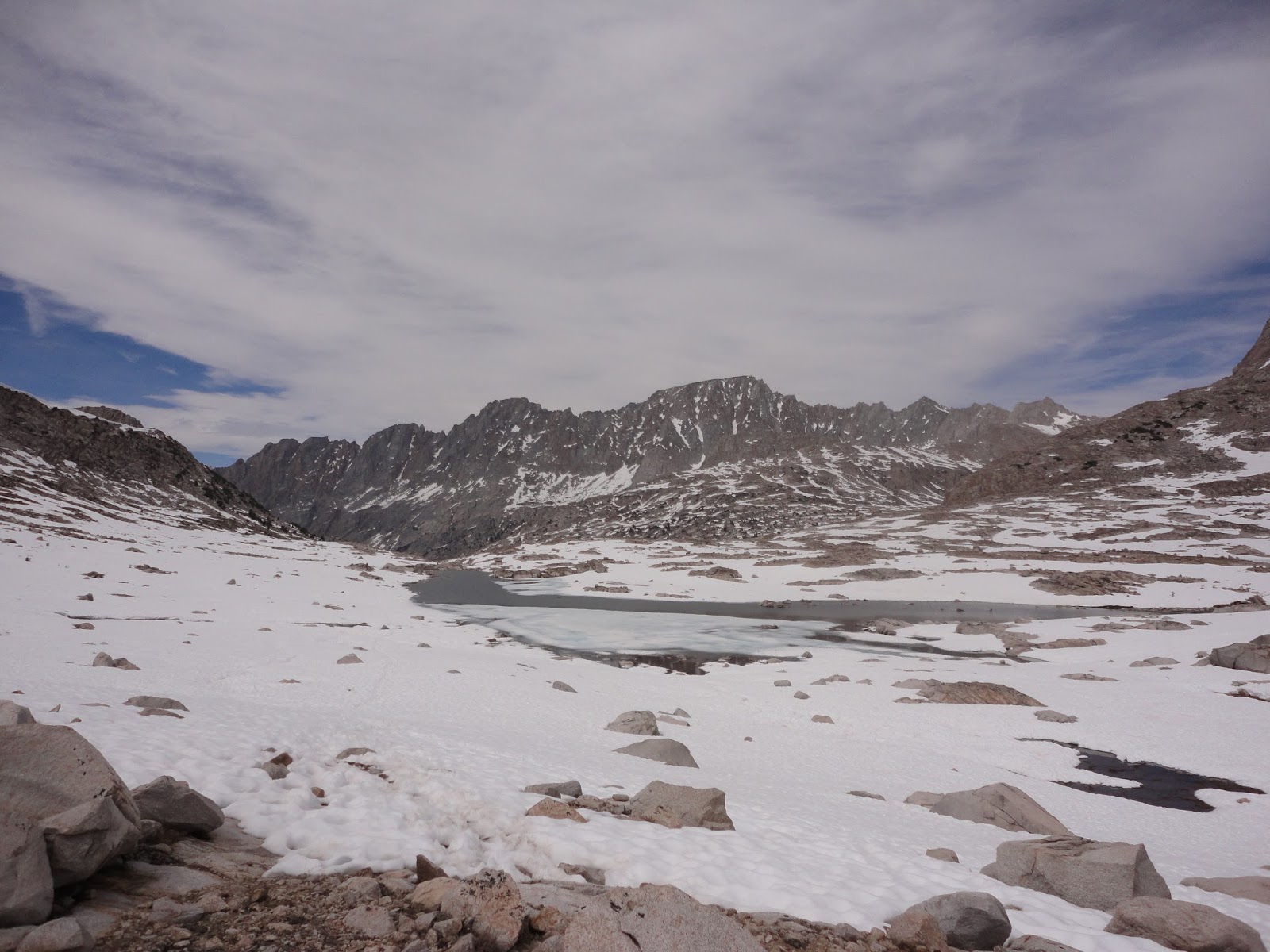
A slightly wet crossing. I started hitting snow patches as I wrapped around Evolution Lake and from this point it was basically solid snow up over Muir until just before crossing the Middle Fork of the Kings (would be day 4). It was warm by the time I got here so it was stop here for the night or try and follow the previous tracks to avoid as much post holing as possible. There was too much daylight left to stop so off I went. The trail over the sun cups was mostly firm with the occasional full post hole if I got too close to a buried rock.

Saphire Lake


Muir Hut.

Room with a view. My campsite for night 3. I descended to just above some nameless (at least on my map) lake below Muir Pass but above Helen Lake. I had the place to myself with no other tents in sight. I watched the sunlight fade and be replaced by the moon. The snow reflected the moonlight and there was no need for a headlamp when getting out of the tent in the middle of the night.

Where's Waldo? My tent is hidden in the rock band. It was my favorite night on the trail.
Day 4 was a lot of descending and more snow. My goal for the day was Dusy Basin which would give me a shorter hike out to the car the following day. I got an early start so the snow was still hard and I put my microspikes on for added traction. There were a couple of tricky and steep downhill sections, but I felt more confident with each section I successfully made it down.

Helen Lake


Getting to the end of the snow. It was amazing how much the landscape could change in just a few miles.

The JMT heads straight down this canyon. I'd be headed east about halfway down to get to Dusy Basin and Bishop Pass. On my first JMT attempt I spent the night near where the Bishop Pass trail cuts off.


Looking up at the creek that comes down from Dusy Basin.


The JMT is waaaay down there.

Dusy Basin. My campsite for the night. There was still time for hiking, but I decided to stop a little early. It was getting really windy and darkish clouds were on the horizon. A storm never actually materialized, but it was nice to explore a little without the pack and do some reading.
Day 5 I got an early start and I wanted to get over the pass while the snow was still firm. I expected some snow, but not nearly as much as what was there. Despite the early hour the snow was already soft on the west side and a lot of postholing was involved. The east side of the pass was more north facing and there was a lot of snow on fairly steep slopes. I spent a fair amount of time looking for the safest route down. It looked like a lot of people had been butt sliding down the hill, but it didn't seem like a wise option. The snow was bulletproof and the end of the slide paths all ended in a rock field. I ended up taking a much longer route and played it super safe. I carefully planted each foot and pole before moving forward and eventually I made it to the bottom safely. It ended up being the toughest section of the entire loop for me.
I finally got to the pavement and it was so early there weren't people leaving the trailhead yet. I had planned on hitchhiking to get back to my car to save me a 8-10ish mile pavement hike to get back to my car. I ended up getting a ride after walking 5 or so miles.
I briefly though of stopping by the ranger station on my way home to give an update on trail conditions (prove him wrong), but I was tired and excited to get home to Ryan and Bliks. The experience has prompted me to consider some ski camping trips this coming up winter. I love the mountains in the summer, but there is something about being out there when everything is draped in snow. I was also feeling slightly more prepared for my JMT fastpack coming up in July
Trip dates June 16-20, 2016
Trip dates June 16-20, 2016

Top of Bishop Pass

The start of the descent down Bishop Pass.

The steep part of the descent. I ended up descending the part along the rock band on the top of the picture. It was not as steep on that side.
Niceness . . . I've only done early season a few times, but it's pretty grand.
ReplyDeleteMy friend and i are going to do the JMT in Late Aug/early Sept..we did Whitney last June, on the first day the cables were open-the Ranger was SUPER negative as to the conditions and our ability. We were fine. Tired w 5 hrs hiking up the switch backs postholing...but fine. Your trip was inspiring.
ReplyDelete