I first started looking at the Alpine Challenge 100 miler about 2 months prior to the event. We were driving home from Ryan's race at the Bear 100. I hadn't planned on doing a fall event, but at that moment we were waiting to find out if I was going to miscarry again. The next couple weeks were filled with doctors appointments and then a d&c when my body didn't miscarry on its own. Mid october I decided I needed something to focus on and I signed up to "race". I knew I wouldn't be my fittest, but I also knew the challenge of getting ready in 6 weeks would give me something else to focus on. I had a solid base from a summer spent on the JMT, but August and September had been very low mile months. I primarily picked Alpine due to the date (we had time off work) and that fact that is was a Hardrock Qualifier.
There wasn't a lot of information online about the event. I knew it had about 26,000 ft of climbing and was over an unmarked course. Aid stations were going to be unlike anything here at home with most of them having water fills only..... oh and they would be much further apart. I think the longest section without a checkpoint was about 30 miles. I also had to carry a large amount of mandatory gear.
- Emergency space blanket/bag/light bivvi sack or equivalent
- Personal First aid requirements, bandaids, antiseptic, painkillers etc
- 10 cm elastic bandage for snake bites/sprains. NB: cotton crepe bandages are NOT acceptable
- Personal Location Beacon or similar (1 per solo/team)
- Emergency heat pack
- Spare clothing/runners (with support crew)
- Sun screen
After looking at the gear list all I could see was snake bite bandage. I watched videos on how to apply and thought to myself it is early spring there and still snow on the ground... how bad can it be. I tried to get the gear together in my Ultimate Direction Peter Bakwin pack, but I couldn't get it to fit and this was without having water in the pack. I ended up wearing my UD 20L Fastpack.
I did as much training as I could reasonably do in 6 weeks without overdoing it. My biggest day was doing the Hilloween hill climb on Oct 29. Thanks Julia Millon! Without this I would have been completely, instead of mostly, unprepared for the steep ups and downs of the Alpine Challenge. I ended up getting nearly 16,000 feet of climbing done in 25 miles.
Finally we were on out way to Sydney. We had rented a camper van with the plan of post race heading to the coast and then driving it up to Brisbane. We landed in Sydney and the race was in the mountains about 10 hours away by van. We landed on Thursday and the race started 5am on Saturday. Only a day and a half to get there. It took us over 2 hours just to get out of Sydney. The van rental place didn't have maps and just sent us in the general direction. Driving a manual on the left hand side didn't make things any easier but eventually we were on the highway and making good time. The next day we got up early and headed to the race venue. The road to Falls Creek was super tight and windy. Eventually we got there and found our hotel. There was no one there. We hung out there for a couple hours trying to find a way in or anyone that would help. No luck.We tried calling, but the phone we had bought and put over $20 in credits on wouldn't complete the call. I started having a massive meltdown and told Ryan we should just scrap the race and head for the coast and start the vacation part of our trip. Eventually one of the neighboring hotels told us that the hotel had recently been sold and was no longer open. Thanks Priceline! Closed hotel that was already paid for. At this point I was done. 24 hours of air travel combined with 12+ hours in the car and I just wanted to go to the beach. Ryan then found out we had been rebooked into another hotel a street over. Not ideal pre race stress, but we were finally checked in and headed to the pre race briefing.


Fun little camper van! Ryan cooking me breakfast in bed.

Day before the race shake out run.
There was a special pre race briefing just for international athletes. The topic of this was SNAKES! Good times. Turns out they are all venomous and some had been seen the day before on the race course. We learned how to properly apply our elastic bandages. I'd already seen the videos online, but this somehow made it all the more real. Their fangs are supposedly short and would feel like branches hitting the leg or ankle if we were struck. We were told the snakes would be small compared to rattlesnakes back home and would probably be in grassy or leaf littered areas. Okay I got it. The main briefing reviewed the course and I marked my paper map and reviewed both of my GPS files. I had downloaded the Gaia maps of the area and a file with course outlines on it.

Finally gear was all sorted and pack was ready for the next day. The 5 am start was cold! The first 4 or so miles of trail were fantastic! Perfectly groomed sweet flowy slightly downhill singletrack. I was somewhere in the middle of the conga line keeping a comfortable pace on the mellow downhill. We had been warned at the briefing that after this nice section there would be a steep downhill on a fire road and after that we would start to climb. I took it easy on these first sections, and soon I was down the "steep" downhill where we'd been told to take it easy. I was thinking that this wasn't too bad. It was all perfectly run-able. Then the first climb started and I got into what I thought at the time was the "rough" section. It had been a double track that was terribly overgrown. The footing was tricky, but I enjoyed the climb. About halfway up this climb I was already pulling out my phone to look at the GPS to see where the "road" went. It was so overgrown that I couldn't pick up faint track that was winding its way up the hill.
At about 15 miles we passed through the first checkpoint at Warby Corner. This was a water spot. It was also where I'd see Ryan and pick up my food for the next 30+ miles. At this point we were on a nice fire road and I thought I'd seen the worst of the trail. Oh how wrong I was. I did a quick stop changed out my food and filled up my water. I left my puffy with Ryan as it wasn't part of my mandatory gear and hustled out of the checkpoint.
The next section started on a mellow double track for a couple miles and then we made a right hand turn that followed a pole line. The trail quickly got steep and narrow and then almost completely petered out. Two guys flew past me and I tried to hang with them, but it wasn't happening. It felt like we lost 3000 ft in 3 miles descending to the river. I was using my poles to slow my descent and try not to fall on my face. The trail didn't switchback, but seriously went straight down. I knew my quads were going to hate me. This was only mile 17 or 18. It was going to be a long day and night. With all the overgrowth on the trail it was hard to see footing and all the branches kept hitting my legs. All I could think of was SNAKE. There would be no avoiding a snake if there was one there.

I finally got down to the river and was super happy to be done with that section. I stopped at the river and filled up my water. We had been told in the briefing that we could fill here and again at a river crossing at about mile 40. Other than this I didn't know where water would be available. The temperatures were heating up and the water was cool and refreshing.
The climb started and it was just like the other side. Straight up. I was so glad to have brought poles and I enjoyed the climb much more than the descent. The higher up I got the more the trail started to level out. I climbed up from the jungles to almost tundra like vegetation. The trail became more defined and easier to follow the higher I got due to the lack of vegetation.

Following the pole lines

Straight up

Mt Bogong

The ridge line at Mt Bogong. I promise there is a "trail" in this photo.

Following the ridge line down.
After all that climbing I had forgotten how much I had struggled with the previous descent and was looking forward to making up some time on the downhill. This would not happen. The first section of the descent was rocky and technical, but then I got to the tree section (see photos below). For what felt like 10 miles, but was probably 2 miles the trail went through a section with downed trees. My quads already hated me and now I was climbing under, over, and through trees. I'd


Warby Corner snowman.

Heading into Warby Corner for the second time.
Finally I was at the checkpoint! Ryan had brought in my second pair of shoes and dry socks so I sat here for about 30 minutes with shoes and socks off to let my feet dry out. I took advantage of this time to eat some real foot and lay down with my feet elevated in the sun. I didn't care if I was losing time. If I didn't fix my feet here, then I would be done later. I still had 55ish miles to go and I was completely broken. I should have had Ryan get photos, but I was lacking energy to do anything other than eat and breathe at this point.
I finally shuttled off down the trail. It was a slight downhill perfect fire road and I was reduced to a walk/shuffle. I had lows in racing before, but I'd never been reduced to a walk this early in a race due to destroyed legs. I had no energy and wasn't looking forward to 55 miles more of this. Ryan came with me on this section as his car was at the next checkpoint. He had hiked in to Warby Corner. I was happy to have the company and without his gentle prodding probably would have quit right there. Warm beaches and lounging around sounded like much more fun that what I was doing at the moment. Ryan kept telling me that it would get better. It did, but not until sometime the next day.

Somewhere between Warby Corner and Langsford Gap
The next checkpoint at Langsford Gap was only 4-5 miles away and we eventually got there. I filled water again not knowing if there would be any creeks to fill in between here and the next water point 18 miles away. I said goodbye to Ryan and headed off. From here we followed an aqueduct and it was flat dirt road. I kept walking. My legs were done, and I felt completely demoralized. Pole 333 was the next checkpoint and where I'd have to decide if I would continue on with the 100 mile or head back to the finish for the 100K. I did a quick check on how I felt and I wasn't any worse or better than I had been at Warby Corner so I made the left hand turn towards the 100 mile course.
The course got steep and rough again and after a lot more downs and ups I was watching the sun set as I was headed into Loch Car Park. It was completely dark when I was about 30 minutes out from the check point, and I stopped to add layers and pull out my light. I could see the flashing lights of the CP on the mountain across from where I was. I could also see the headlamp of a runner headed my direction. Ryan ran out a quesadilla and some positive energy out to me! He asked if I felt any better. No, I was definitely not better, but I didn't feel any worse. I went inside at the checkpoint and put on my fleece tights and jacket and headed back out into the night. I got lost several times on the next section. Route finding on an unmarked course in the dark on trails that are often not much more than animal tracks was tough. I checked my GPS frequently during this section and recognized my mistakes early preventing them from being disastrous. This section of trail had jungle like vegetation and I kept tripping and falling. My poles saved me from the worse of the falls and a couple miles out from the aid station I saw another headlight. Ryan had hiked out to run into the CP with me. He lied and told me I was doing great and didn't look that bad. I didn't believe him, but it was good to have him with me even if just for a couple miles. At the Harrietville CP I got in the van and ate a cup of noodles. I put my legs up for about 20 minutes before finally motivating enough to get back out there.

I had about 20 miles to go and it was 2am. The race has a 44 hour cutoff so I'd make that even at my pace. Leaving this CP was the biggest climb of the race. I was feeling a little sleepy so I took a caffeine tab and all of a sudden I was on fire. No, I wasn't running, but I was a power hiking fool. I passed 3 people on this climb and had another in my sights. The climb went on forever, but it seemed my legs were finally coming around. The top of it ended with an out and back to Mt. Feathertop. The last half mile was steep and rocky with what looked like endless drop offs on both sides. I'm not the biggest fan of heights and doing it in the dark had me down on all fours climbing. I got up to the top with another runner just as the sky was starting to turn orange. It was going to be a beautiful sunrise, but I wasn't going to hang around here to watch it. Soon we were down on the main ridgeline and I made another pass. I was finally running again!
The next section was Diamantina Spur. The course notes said "Diamantina Spur is steep in places with lots of loose shale and rocks—descend with care". How understated! Sections had the brush cut back, but the brush was across the trail. I kept tripping and falling on the brush. The steep section involved some down rock climbing. Around this time I caught and passed the lead female. I might have looked bad, but she looked worse. She said her GPS had run out of batteries and she'd gotten lost several times. I wished her luck and quickly moved along. I was super glad I'd brought along the larger power bank with me. The extra weight had been worth it. My GPS had been my lifeline, especially at night. Yes, I had a map and compass, but with trails being more like animal tracks it was far easier to follow on the GPS. I started moving really well after the descent and onto the last major climb of the course. I knew Ryan would be hiking out on the course to the Pole 333 CP and was looking forward to seeing him. It was a little over 6 miles from Pole 333 to the finish. I was actually going to pull this off.
The last 1.5 miles of the course actually had the only course markings of the entire 100 miles and this was because we were following ski hills rather than trails at this point. It was a super painful descent, but I finally made it to the finish in 29 hours and 47 minutes.
Totally exhausted I hung out at the finish line for a couple hours trying to get the energy up to get back to the van. Ryan went and arranged for a hotel again that night as sleeping in the van without a shower might have been a really bad idea.
So, a month out what do I think of the race? I still think it's the hardest 100 I've ever done for a variety of reasons. Unmarked course, no real aid stations, check points/water points that were very far apart in places, and a big gear list all made it hard. The toughest thing for me was mentally and physically I wasn't prepared for the race conditions. Living in the Sierra I'm spoiled by amazing single track climbs and descents. While I was prepared for large elevation gains/losses..... I wasn't prepared for them being in such few miles. There was a lot of run-able miles in between these large climbs/descents. The straight ups/downs and the rough trail/track conditions destroyed my legs. Walking for nearly 50 miles demoralized me. I hadn't trained appropriately for the conditions I faced, and I paid the price. Am I glad I did it? Hell yes! I got my Hardrock qualifier for next years lottery and I got to complete a tough beautiful course. I wish I'd known more about the course in advance as it would have made the journey a little more enjoyable. I wouldn't describe this as a typical US 100 miler. It was so much more. It felt more like an adventure race. Looking back it was a great experience. Amazing what a month of forgetting the pain can do!
Thanks to Paul and the Alpine Search and Rescue for putting on such a challenging tough event! Everyone out there was super helpful and friendly.


My I'm totally over this face.


Course map. Looks like I spent 3+ hours not moving! I knew I'd spent a fair amount of time not moving while filling water, drying feet out, and route finding, but over 3 hours!?!

Lounging at our hotel post race.
Now we were off on vacation. 2+ weeks of driving from beach to beach and we worked our way to Brisbane.

The view of Mt. Bogong from Mt. Beauty.


wombat


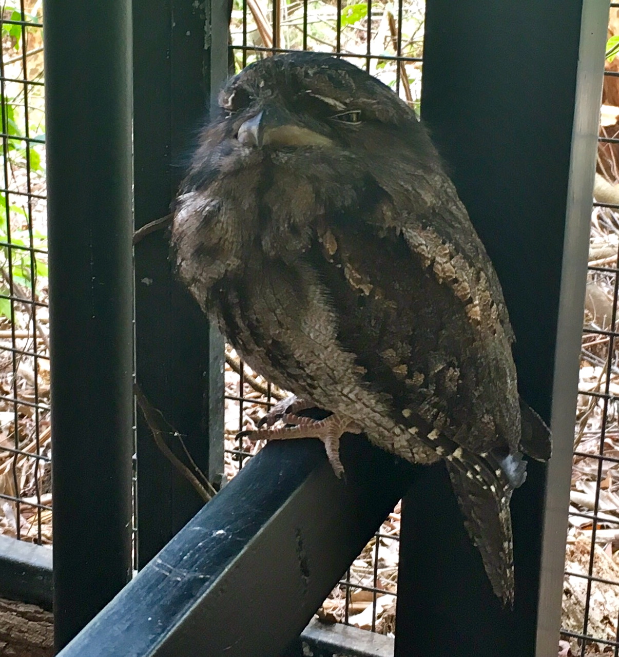
There were birds everywhere. We could hear Kookaburra most days in the campgrounds. We would stop everything and listen to their calls.

Rainbow Lorikeet


Flying foxes. There was 1000s of them in the surrounding trees. That night there was an epic thunderstorm and every time the thunder boomed we could hear them shrieking.

Tasmanian Devil


The best fish and chips


Kangaroo learning how to take a selfie

After running 100 miles this felt good!

Although we did do some running.

Found a fantastic little 10 mile coastal trail from Port Macquarie.


We ended up returning the van in Brisbane and flying into Sydney where we would spend the last 2 days of our trip on foot. There is no better way to see a city. Sydney is my new favorite city. Amazing public transport and a really fun vibe. Friday night the whole city seemed to be dressed up and ready to party. We stumbled upon fireworks over Darling Harbor. We called it a night at around midnight and people were still waiting for tables for dinner.

Sunset drinks at the Opera House bar.


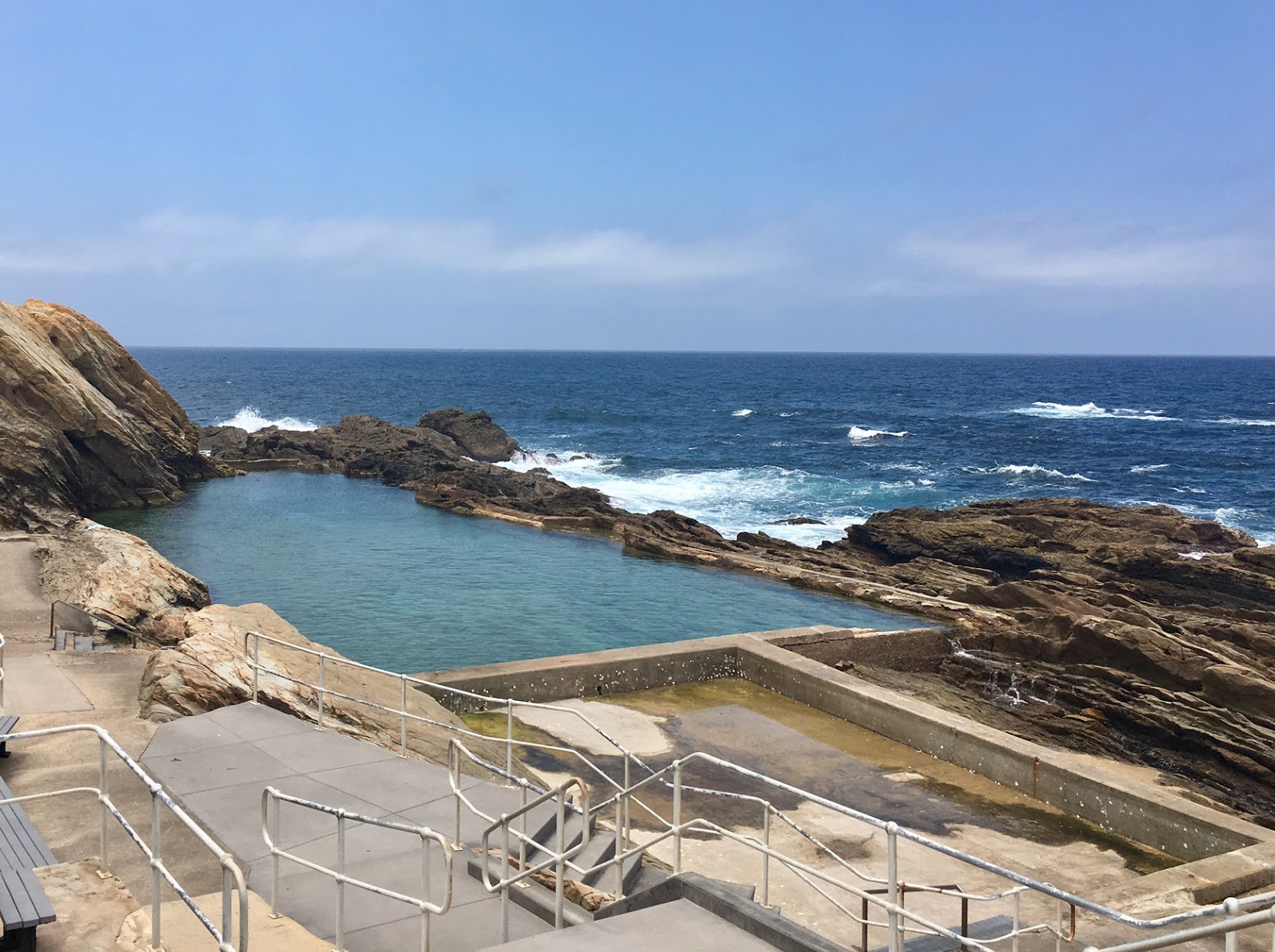
The next day we got up early and ran from Circular Quay (where we were staying) out to Bondi. At Bondi we discovered a coastal path that went to Coogee. That section of path is a must do. Originally we were going to take the bus/train back to the city, but decided to run back exploring along the way.

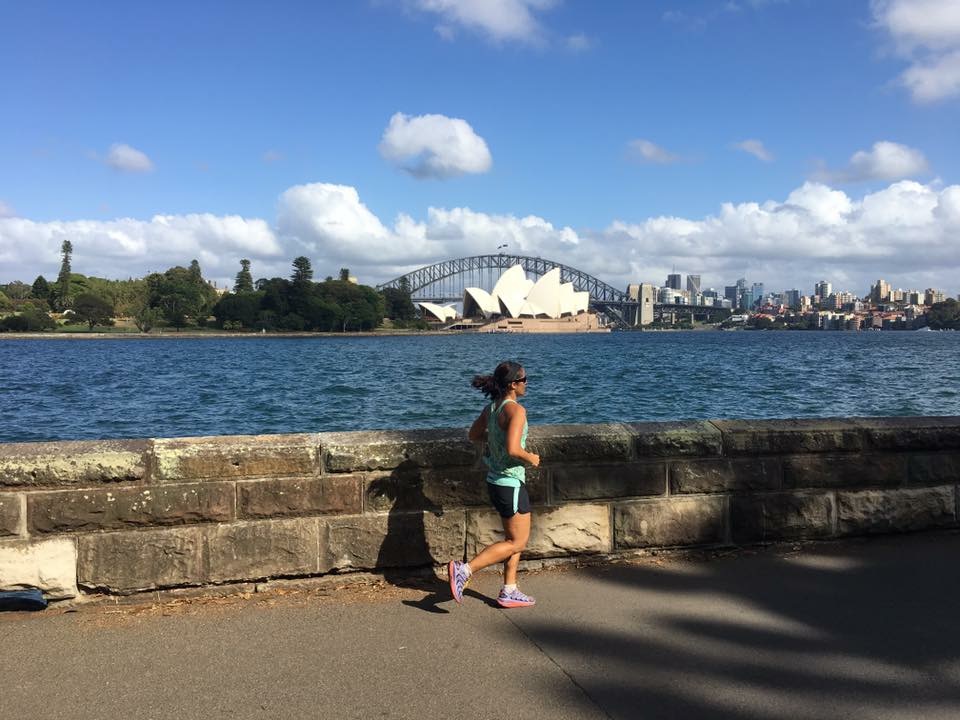
Fun city running!

Bondi Beach

Coastal path


We got back from that adventure around 1pm and hoped on a ferry to Manly. Since our 20 mile exploring run hadn't done us in yet we went for another exploring hike/run to the headlands where there are old military remnants from WWII.

View from the Ferry


Headlands


Overall an amazing and relaxing trip. Having the 100 mile event at the beginning was tough, but it was nice to be able to not spend half the trip waiting to race.